With a loud hum, the drone takes off from the ground. It is transporting a package to the city center. On its way there, it flies over streets and factories and past high-rise buildings. The drone could crash or miss its intended target due to the different interfering influences. Some examples of interfering influences include buildings which block or reflect the GPS signals.
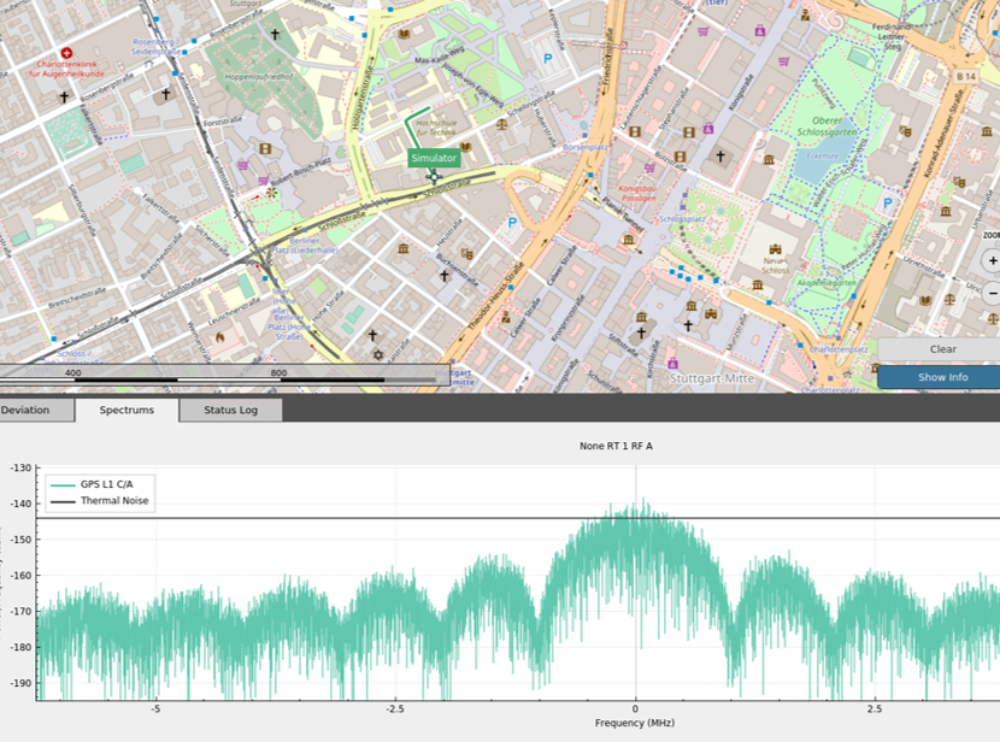
The INS is now using software from the company Orolia which students can use to simulate these scenarios. The so-called Skydel software sets the route for the students to navigate virtually. Measurements along this route, which would be taken by a GPS receiver in real life, are simulated. Alternatively, researchers can also connect a real GPS receiver to the simulator. This means a drone flight can be simulated using real data. By using the software, students can practice different scenarios without putting anybody in danger. The simulation is also less complicated than using a real drone to transport a package through a city like Stuttgart.
The software prepares students for research and careers
What makes the software special is that it covers everything which is currently offered by satellite navigation services. The University of Stuttgart is the only university in Germany which works with this software. The INS uses the software to offer students the chance to supplement lectures and exercises with more practical elements. Prof. Thomas Hobiger from the INS says: “We want to make sure that our graduates are as well prepared for the demands of industry and business as possible. By using simulation software in teaching we familiarize our students with concepts such as hardware-in-the-loop, and provide them with extra soft skills which they can put to good use straight away for potential employers. What's more, our students can run through navigation scenarios which it wasn’t possible to represent before.”
The Skydel software is also used in research. Researchers simulate scenarios in real time in the laboratory and send the signals to commercial or self-developed receivers by using so-called software-defined radio hardware. This makes it possible to also simulate observations using other global navigation satellite systems (GNSS) as well as GPS signals, such as the Chinese BeiDou, the Russian GLONASS or the European Galileo. By using Galileo, the Institute of Navigation can keep the research up to date with the latest innovations promoted by the European Union and thus develop precise and reliable positioning and navigation algorithms.
Precise simulations improve algorithms
Besides the main focus on autonomous flying, INS also carries out research into estimating satellite orbits, navigating safely in urban or complex environments, or measuring atmospheric parameters based on GNSS measurements. In future, researchers want to use the simulation software as a tool to be able to describe the accuracy, availability and reliability of the algorithms and hardware solutions developed. “Using the software means more than just not having to carry out costly and time-consuming field tests, now we can also compare our navigation solutions with the simulated trajectories as well as being able to show the absolute accuracy of our algorithms, meaning the deviation from the actual position”, explains Hobiger.