

Study program structure and content
During the first three semesters, you will learn the fundamentals of mathematics, natural sciences, and engineering. You will attend courses in advanced mathematics, physics, computer science, statistics, and geodetic measurement technology.
Geodesy is a highly application-oriented study program. From the third to the sixth semester, you will focus on application-oriented specializations. In areas such as satellite geodesy and physical geodesy, for example, you will explore the fundamentals of satellite orbits and the Earth's gravitational field. In engineering geodesy, you will learn about surveying methods and planning structures related to the surveying of buildings. In photogrammetry and digital image processing, you will learn about methods for measuring and creating 3D models from images. In field projects lasting several days, you will apply the knowledge you have learned independently in groups.
- Program structure [de]
For more information on the study program structure please consult our German website - Curriculum and module handbook [de]
In the C@MPUS portal, you can view the structure of the study program. Clicking the book icon opens the module handbook with detailed information on course content. - Information on the Bachelor of Arts and Bachelor of Science
Click here to learn more about the Bachelor's degree in Germany
Studying abroad
Intercultural exchange, enhanced language skills, fresh perspectives on your field of study, exciting adventures, lifelong global friendships, personal growth, and a valuable boost to your CV — all this and more awaits you during a stay abroad! Are you interested in studying abroad for one or two semesters, or doing a language course or an internship, or would you like to take part in a summer school? The International Office will help you to make your stay a reality.
- Find out more about your options!
Everything you need to know about studying abroad: group advice, partner universities, language requirements, application deadlines, funding.
Images from the study program
Get a glimpse of how the study program works:
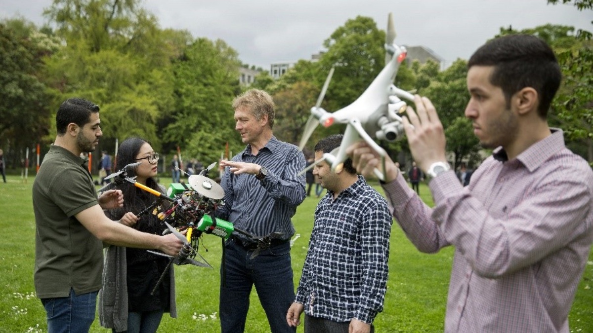
Because we are a relatively small study program, contact and interaction between students and teachers is very personal. Here, a teacher explains to students how to use drones for image-based 3D object capture as part of a course.
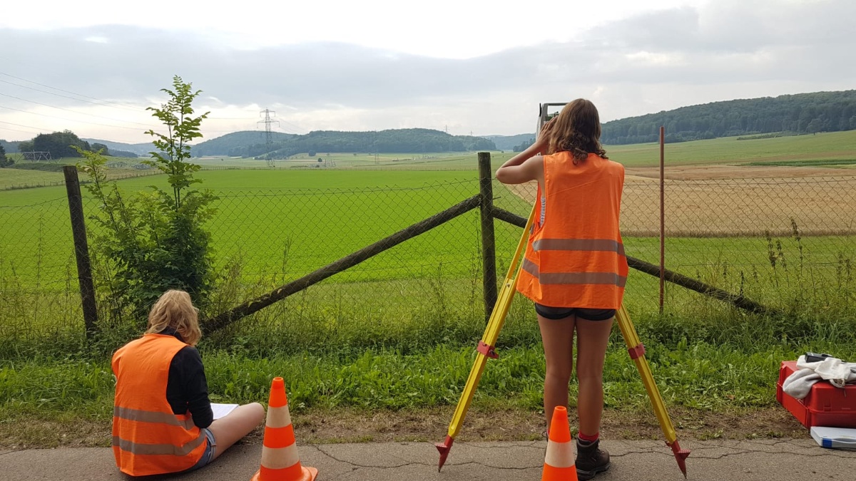
Most courses are accompanied by exercises in smaller workrooms, which are led by student tutors. Some of our exercises, especially the measurement technology exercises, take place outdoors.

Programming is an important part of the course. You will learn programming skills in the first two semesters in the “Computer Science” module. The later module “Geoinformatics” is a subfield of applied computer science and forms the scientific basis for geographic information systems (GIS).
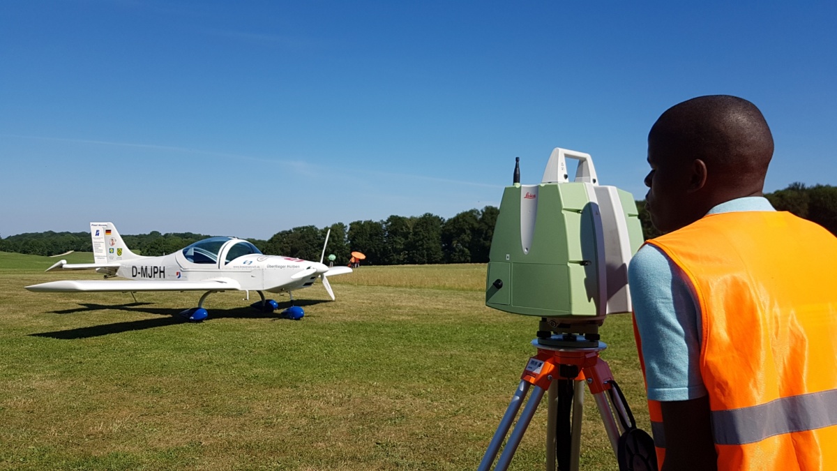
The integrated field project provides practical experience during your studies. Here, the knowledge acquired is applied independently in groups in the form of projects. For a period of 10 days, joint fieldwork is carried out to implement the projects. In addition, excursions organized by the institutes both domestically and abroad offer the opportunity to experience cutting-edge technology up close, as seen here during an excursion to the German Aerospace Center (DLR).
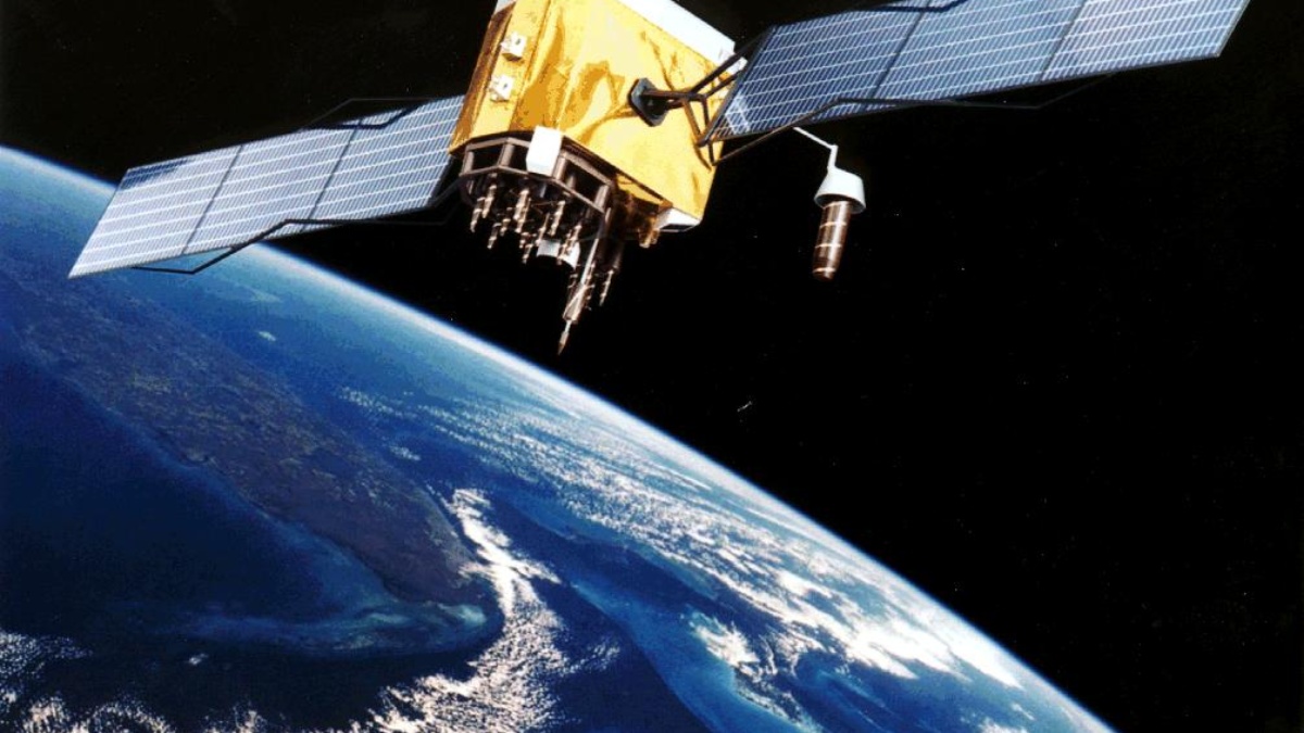
GPS Satellites
Satellites are widely used in modern geodesy, for example in navigation systems such as GPS, but also for observing global phenomena on Earth such as sea level rise or the melting of the polar ice caps.
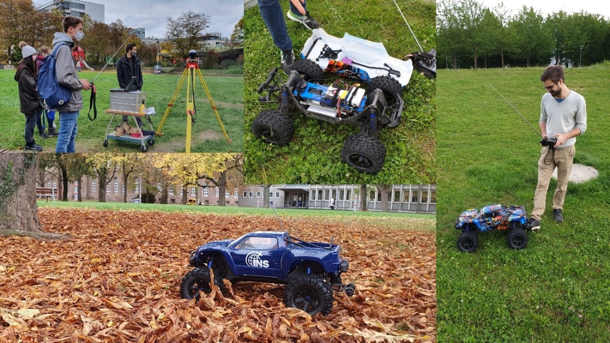
Navigation sensors
When driving autonomously, the exact position and movement behavior of the vehicle must always be known. Satellite-based methods and inertial sensors can be used to determine these. The image shows a test drive with a remote-controlled model car with built-in navigation sensors.
Image: (c) INS
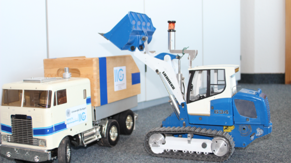
Excavator control
For example, the control of moving objects is used for the automated operation of construction machinery. Here, the charging processes are carried out fully automatically. A model caterpillar loader on a scale of 1:14 is used as the test object.
Image: (c) IIGS
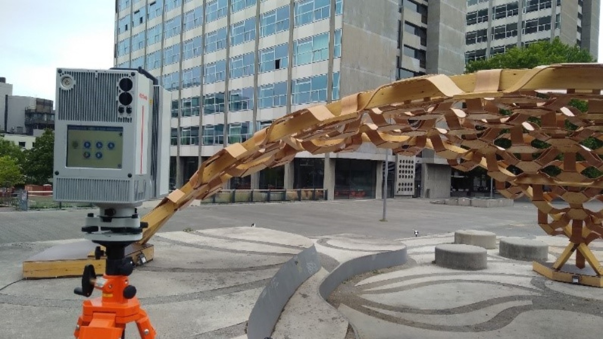
Deformation measurements
Compliance with dimensions plays an important role in the construction of new buildings and structures. After completion, this pavilion on Campus City Center was measured using a laser scanner and the results were compared with the planned target dimensions. The findings can be used to determine which processes in construction need to be improved.
Image: (c) IIGS

Ice mass change in Antarctica
Geodesy deals with natural phenomena, e.g. in connection with climate change. The figure shows the change in ice mass in Antarctica. This was measured using satellites. Blue areas indicate mass loss, red areas indicate mass gain.
Image: (c) GIS
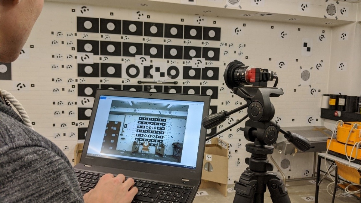
Photogrammetry
In photogrammetry, geodesy deals with the generation of three-dimensional data from several overlapping images. To ensure the accuracy of the calculated 3D coordinates, the geometry of the camera used must be determined very precisely. This camera calibration is performed here using our calibration field.
Image: (c) ifp
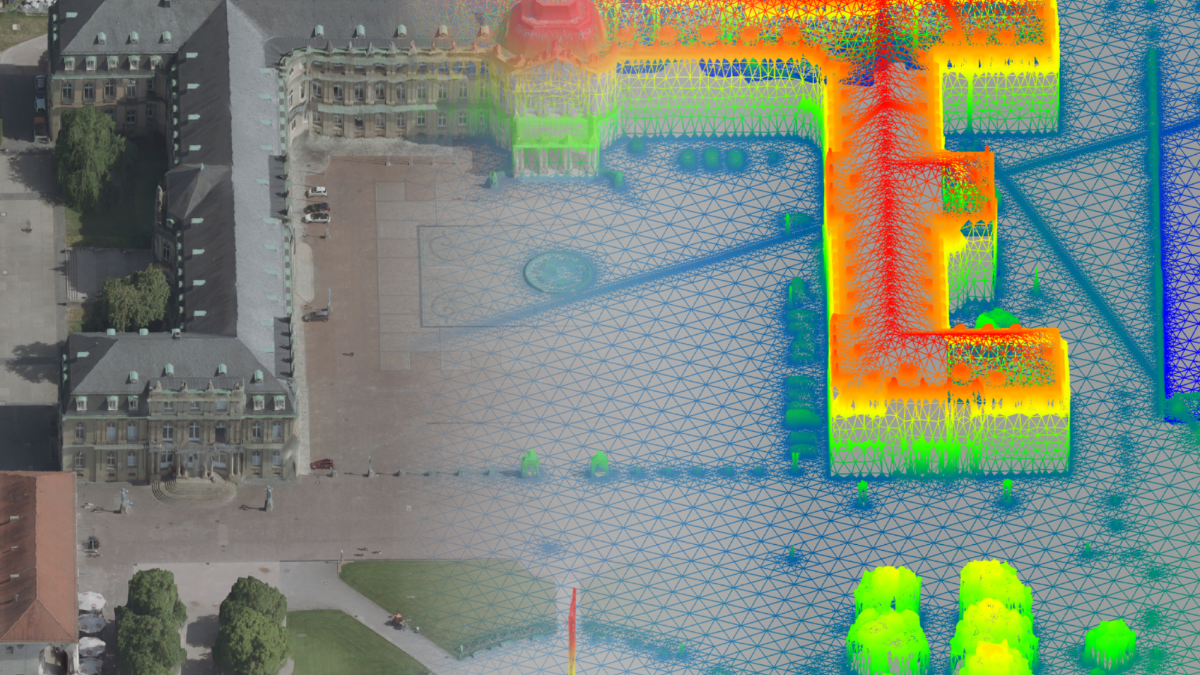
3D data
An example of a photogrammetric reconstruction result is the 3D mesh of Stuttgart's Schlossplatz shown here. Photos were taken from an airplane for this purpose. This data is used to create 3D city models, among other things.
Image: (c) ifp
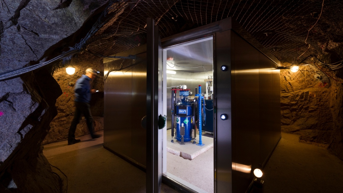
Earth's gravitational field
The picture shows a superconducting gravimeter in an observatory in the Black Forest. The gravimeter measures changes in gravity over time with high precision. Even the influence of heavy rainfall on Earth's gravitational pull can be seen in the instrument's data.
Image: (c) Markus Breig