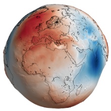
Geoengine-Logo
home uni university search search sitemap sitemap contact contact
unilogo Universität Stuttgart
Institute of Geodesy

GEOENGINE - Map Projections and Geodetic Coordinate Systems

Print view
 
Map Projections and Geodetic Coordinate Systems (320305/320306, 2. Semester, 3 CP)
Instructor(s)  Friedhelm Krumm,  Oliver Baur
Lecture Start: 22.4.10 Thursday / weekly 9:45 - 11:15 h Room: M 24.01 pdf document Lecture Notes (156 pages, 11 882kB)
Lab
Start: 21.4.10 Wednesday / weekly 14:30 - 15:15 h Room: M 24.01 Addons & Links


Written exam problems and solutions
Pages / Size
 written exam problems pdf document (7 pages) 
 exam solutions pdf document (10 pages) 


Course Contents

The goal of this course is to study the various possiblities how to 'project' an idealized Earth - Earth models are the Sphere or the Ellipsoid-of-Revolution - onto a planar map. A major part of the course is devoted to the unavoidable deformations which occur during the mapping process. Special attention is payed to optimal as well as legal and widely-used map projections, i.e. Gauß-Krüger/UTM with their specific geodetic coordinates and coordinate systems. Datum transformation models are presented in order to transform sets of coordinates from one reference system to the other.


Pre-requisites

Knowledge of Advanced Mathematics (Module 1).


Recommended textbooks

  • Bugayevskiy L M and J P Snyder (1995): Map Projections - A Reference Manual. Taylor & Francis
  • Canters F and H Decleir (1989): The world in perspective: A directory of world map projections. Wiley
  • Grafarend E W and F W Krumm (2007): Map Projections, Cartographic Information Systems. Springer
  • Heck B (2003): Computational Techniques and Models of Mathematical Geodesy. Classical and Modern Methods. 3rd, Updated and Enlarged Edition. Wichmann Heidelberg (In German)
  • Hofmann-Wellenhof B, H Lichtenegger and J Collins (1997): GPS - Theory and Practice. Springer
  • Hooijberg M (2008): Geometrical Geodesy Using Information and Computer Technology, Springer
  • Iliffe J (2000): Datums and Map Projections for Remote Sensing, GIS, and Surveying. Boca Raton
  • Kühnel W (2002): Differential Geometry. Curves - Surfaces - Manifolds. Student Mathematical Library, Vol. 16, American Mathematical Society
  • Maling D H (1992): Coordinate Systems and Map Projections. 2nd Edition, Oxford
  • Pearson F (1990): Map Projection: Theory and Applications. Boca Raton
  • Snyder J.P. (1987): Map Projections - A Working Manual. USGS Professional Paper 1395, United States Government Printing Office, Washington


several mappings

Tissot Distortion Ellipses.


utm grid germany

UTM Reference Meridians, Zones and Grid in Germany.

Demo Strip System


transformation models

Datum Transformation Models.

hoch